Ganga Erosion Swallows Historic Shiva Temple in West Bengal
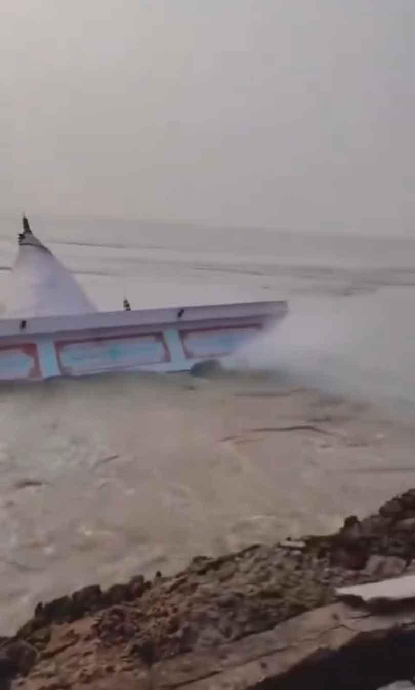
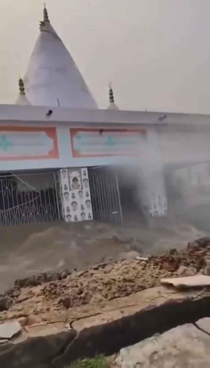
For generations, a Shiva temple stood on the banks of the Ganga in West Bengal’s Malda district, surviving changing seasons, monsoon rains and the gradual movement of one of India’s greatest rivers. Then, within moments, the ground beneath it disappeared. The historic temple at Muliram Tola, in the Mahanandatola area of Malda’s Ratua I block, collapsed into the Ganga on Sunday, September 6, after severe riverbank erosion undermined the land supporting the structure. Reports published the following day described the temple as roughly 150 years old, although some accounts placed its age closer to 175 years. Footage of the collapse captured the final stages of a process that communities along the Ganga know all too well. Water churned against the exposed bank as the river stripped away the soil surrounding the temple. With its foundations increasingly unsupported, the structure tilted towards the water before collapsing into the river. The images quickly circulated online, turning a local episode of erosion into a striking illustration of a much larger problem.
For residents of Muliram Tola, however, the loss was more than a dramatic moment caught on camera. The temple had served generations of worshippers and was part of the physical and religious landscape of the village. Some reports described it as the village’s only Shiva temple. Residents had reportedly tried to protect the threatened riverbank with sandbags, but temporary measures were ultimately unable to stop the Ganga from advancing.
Its disappearance came as Malda faced worsening flooding and erosion, with rising water levels placing settlements, farmland, roads and public buildings at risk. Reports from the district said erosion was affecting several areas, including Srikantatola, Jittutola and nearby settlements in Ratua I. More than 100 houses were reported to have been lost to the river in affected areas by the 7th of September 2026. The temple therefore became the most visible casualty of a crisis extending far beyond a single building.
Elsewhere in Malda, conditions were also deteriorating. Bhutni island, in Manikchak block, was among the areas severely affected by flooding. Road connections were disrupted, while the local hospital was forced to close and primary medical services were shifted elsewhere. Pregnant women were moved to school buildings in Manikchak as authorities responded to the emergency. Erosion was also reported in English Bazar, where sections of land and mango orchards were lost. The destruction unfolding across Malda is not simply the result of one unusually powerful current or a single period of high water. Riverbank erosion has shaped the district for decades, repeatedly changing its geography and threatening communities established close to the Ganga and its connected river system.
A major technical report prepared by a committee examining erosion along the Ganga and Padma system has documented the scale of the problem. The report identified Mahanandatola, covering about 60 square kilometres in Ratua I, among areas facing a severe erosion crisis. It also noted that more than 200 square kilometres of fertile land in Malda district had been affected by erosion by 2004, according to figures reported by the state government. The geography of the region helps explain why the problem is so difficult to contain.
Large rivers do not remain fixed permanently within neat channels. They carry enormous quantities of water and sediment, particularly during periods of heavy rainfall and high flow. Banks can be cut away in one location while sediment accumulates elsewhere. Channels migrate; islands change shape and stretches of land that once appeared secure can become exposed to the main force of the current. In Malda, these processes are particularly consequential because communities, agricultural land and infrastructure lie close to an active river system. The Central Water Commission’s technical assessment has highlighted the vulnerability of stretches around Ratua I and the confluence zones of the Ganga and Fulhar, also associated with the Mahananda river system. Complex river behaviour in these areas contributes to repeated flooding and bank erosion. The danger is measured not only in metres of disappearing shoreline but in homes, roads, farmland, schools, places of worship and livelihoods.
For agricultural communities, the loss of land can be especially severe. River erosion differs from temporary flooding because the land itself may disappear. A flooded field can sometimes be cultivated again after water recedes. A field removed by an eroding riverbank is physically gone, leaving families to confront questions of relocation, income and long-term security. The West Bengal government has been pursuing engineering works intended to protect vulnerable stretches.
In May 2026, the state Irrigation and Waterways Department listed a major anti erosion project for approximately 5.9 kilometres of the Ganga’s left bank at Kataha Diara in Ratua I. The proposed work covered a stretch beginning near the Bengal and Bihar border at Srikantatola and extending towards the river system downstream. The project is evidence that the vulnerability of this part of Malda was recognised before the temple collapsed. Yet river protection is an exceptionally difficult engineering challenge. Interventions must contend with changing currents, sediment movement, seasonal fluctuations and the enormous force of a major river during periods of high discharge. The Ganga is both a physical force and a defining presence in Indian civilisation.
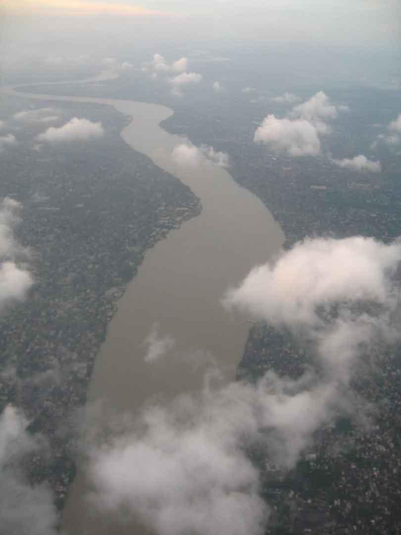
Beginning in the Himalayan river system, the Ganga takes its name at Devprayag in Uttarakhand, where the Bhagirathi and Alaknanda meet. It then crosses the northern plains and travels eastwards through some of India’s most densely populated regions before reaching West Bengal and eventually the Bay of Bengal. The river system is approximately 2,525 kilometres long and supports an immense population. Its water is used for agriculture, domestic needs, industry and other economic activity, while the basin supports towns, cities and rural communities across northern and eastern India.
Its cultural significance is equally profound. For Hindus, the Ganga is sacred, worshipped as the goddess Ganga and closely connected with religious practice, pilgrimage and ideas of purification. Shiva, to whom the lost Malda temple was dedicated, also has a particularly important association with the river in Hindu tradition.
That connection gives the temple’s destruction a poignant symbolism. A shrine dedicated to Shiva, standing beside the sacred Ganga for perhaps a century and a half or longer, was ultimately consumed by the river itself. Yet the significance of the incident should not obscure the practical crisis facing people who continue to live nearby. The temple can no longer be saved. Other structures potentially can.
That distinction places attention on erosion management, emergency protection, monitoring and the difficult question of how communities should adapt where riverbanks remain unstable. Traditional protective measures such as sandbags can provide temporary support in some circumstances, while larger interventions may involve bank reinforcement and other engineered protection. None changes the fundamental reality that the Ganga is a dynamic river whose course has shifted repeatedly over time. Malda’s geography makes that reality particularly visible.
The Farakka Barrage, situated upstream in West Bengal, is one of the major pieces of infrastructure on the river. Around this part of eastern India, the Ganga enters an increasingly complex network of channels before its waters ultimately continue through India and Bangladesh towards the Bay of Bengal. The river’s interaction with sediment, tributaries and distributaries produces a landscape that is continually changing. For people living beside it, that change can occur on a human timescale. A riverbank may retreat gradually for years and then suffer dramatic losses during a period of high water. A house once considered safely inland can find itself near the edge. A road can become vulnerable. Agricultural plots can vanish. Buildings that have stood for generations can suddenly find their foundations exposed. The Shiva temple at Muliram Tola illustrates this progression with unusual clarity. It had survived for well over a century, according to local accounts reported by the Indian media. Its age gave it an appearance of permanence. Yet the stability of any building depends ultimately on the ground beneath it, and the river was steadily removing that ground. By the time the temple fell, its fate had become inseparable from that of the collapsing bank.
The loss has also drawn attention to the difference between a structure’s historical importance and formal heritage protection. Reports widely described the temple as historic because of its age and importance to local residents, but there is no clear evidence in available accounts that it held nationally protected monument status. Its value was primarily rooted in the community that worshipped there and in the generations for whom it formed part of village life. That kind of heritage can be particularly vulnerable. Small temples, shrines, schools and other community landmarks may hold enormous local importance without possessing the visibility of nationally recognised monuments. When they disappear, a piece of local memory disappears with them. The final images from Muliram Tola are therefore powerful not because the Ganga suddenly behaved in an unprecedented way, but because they compressed a long environmental crisis into a matter of seconds. The river had been eroding the land before the camera captured the temple’s fall. It continued flowing after the building disappeared. For communities across erosion prone parts of Malda, that is the deeper concern. The destruction of one temple has ended, but the movement of the river has not. The collapse leaves behind an absence on the riverbank where a familiar place of worship once stood. It also leaves a warning. Along the Ganga in Malda, history, homes and livelihoods can depend on something as fragile as the soil beneath them.